My son Will and I are on a mission to walk the Bruce Trail – all 900km of it – by Oct 2015. This article is part in a series that chronicles our hikes and hopefully sheds some light on what to expect through various portions of the trail: good places to rest, clean water refills, and even a hidden pub or two along the way.
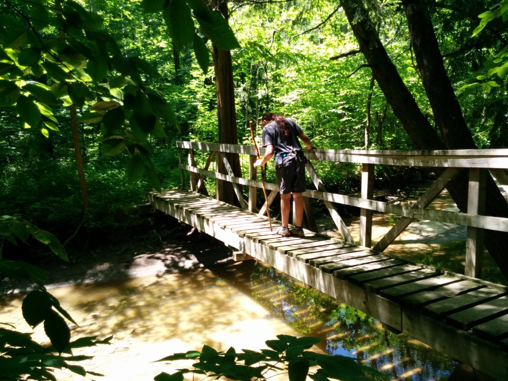
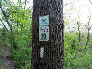
Frequent single-rail foot bridges dot this portion of the trail, making for welcome navigation landmarks in some areas.
Support the Bruce! Whether you walk the trail or not, you can do your part to help preserve the Niagara Region UNESCO World Biosphere Reserve by purchasing a membership in the Bruce Trail Conservatory. Each year, the BTC spends millions in donations to buy and secure development-vulnerable land along the trail route for long-term conservation. Do the right thing, and pitch in to help!
Hiking Log, Leg 3: Niagara Region (81% complete)
(This is a raw copy of our log as recorded on the day. Don’t expect remarkable grammar or content).
Ingress: Niagara Club Region @44.5 Sun, June 15, 2014 10:00AM
Egress: Niagara Club Region @65.0 Sun, June 15, 2014 6:00PM
Total Travel This Leg: 20.5 km over exactly 8 hours
“Mud, Blood and the Dropoff”
We decided to sleep in a bit today; the forecast called for cool temps and a good breeze, so there was no need to put trail behind us before the noonday sun. After a hearty Father’s Day feast of Eggs Benedict (the best breakfast ever thank-you very much), we made ingress just east of the Rockway Falls at 10:00 AM sharp.
Weather at the outset was absolutely perfect: 16C with a steady, cooling breeze.
The mud decided to pay us a visit early on, just a few hundred feet from the road, and within 20 minutes, we were caked up to our ankles. The deep trenches with wide tire marks showed the cause of the mud to be off-road-motorcyclists.
About 30 minutes in – with no cell coverage and on our own for the next 8 hours – our slippery, muddy shoes took their toll. I took a nasty spill on the rocks by a creek and cut my right shin down to the bone. The bleeding was pretty steady, but Will kept his head and was able to help with supplies from the first aid kit and frequent trips to the stream to rinse out our one clean cloth. After about 15 minutes we slowed the bleeding enough to suture the cut closed and pack it with gauze. This is the first time we really needed the first aid kit, and we were glad to have recently re-stocked with fresh gauze and antibiotics.
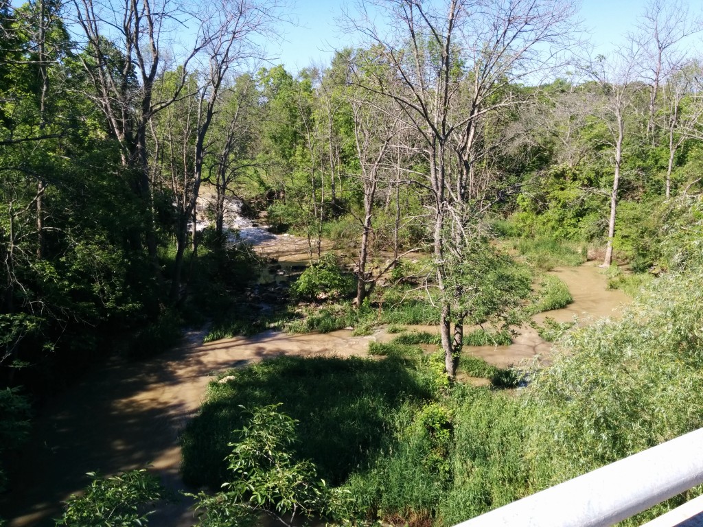
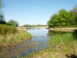
One of a half-dozen waterfalls scattered along this stretch.
Following our early, unscheduled break, we continued along the planned path, which was still muddy, but otherwise easy going. Spider webs crisscrossed the trail for a few kilometres, and we took turns walking in front with Will’s “Galdalf stick” to break through the webs.
The Rockway falls were more impressive than we expected, though they were too distant for us to really aim any decent photos. If weight were no issue, a proper SLR and some lenses would help us capture the unique vistas we pass every outing.
There are precious few landmarks along the trail between Rockway and the intersection with Louth Side Trail. We tried to track our position by counting streams and eyeballing the wider curves, but it seems there are some discrepancies between the 2012 printed map and the current trail route. We’ve seen this before, and while it can make pinpointing position difficult, the maps are generally excellent, well annotated, and, frankly, invaluable for any hiker.
The trail marries up with a few rural roads for about 2km, and both of us were happy for the respite from the occasionally difficult walking. Portions of the trail up to this point involved some serious uphill and downhill treks in the mud – and wet rock surfaces – so a bit of asphalt traction and a chance to dry out really picked up our mood.
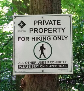
50% of the Bruce still crosses private property. Generous land owners allow passage for travelers, so we are careful to respect their privacy and their property.
Pushing on steadily as we regained the forest trail, fatigue, blood loss and dehydration were starting to take their toll. Our breaks became more frequent. Will was staring to show signs of deep exhaustion, and due to the strenuous terrain, bleeding became a constant problem for me. Will helped changed bandages out every two hours or so to keep the risk of infection at bay.
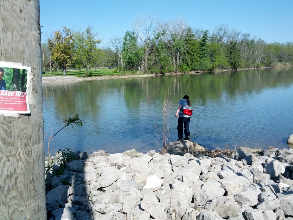
Just as we approached the Balls’ Falls point, we encountered maybe 2 dozen people separated into a few groups. None of them were equipped for hiking, and many of them were complaining about the terrain. This was a sure sign that we were close to civilization of some kind – at least a parking lot.
A very interesting (but in our condition, difficult) roughed-in staircase lead us up the cliffside to a halting site. We emerged – a little bewildered – onto a manicured lawn furnished with shade, a VERY welcoming bench and even a few point-of-interest plaques. It wasn’t much, but it looked comfortable, and immediately, we knew this would make the perfect location for our major mid-day break.
Will drained the 1-litre Gatorade bottle like a shot of smooth whiskey and we both set to work on the dried beef provisions saved especially for our midpoint repast. We tried to pace things a little better with the rations this trip… our theory being that during the last outing, we carried and ate too much.
The leg wound hadn’t taken kindly to the last uphill, and to keep the bleeding under control we elected to bind the leg fairly tightly with hockey tape. I knew this would limit blood circulation, but some cramping and stiffness would be better than constantly worrying about bleeding and the state of the sutures.
With the first aid behind us, Will enjoyed a refreshing repast while I checked for signs of further civilization and the promise of fresh provisions – especially potable water or maybe an ice cream truck.
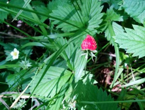
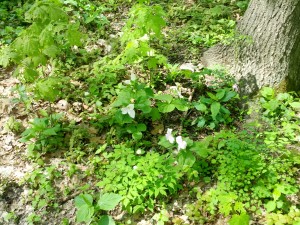
Wild Strawberries sprung up like weeds all around us. There will be some happy rabbits here for the next few weeks.
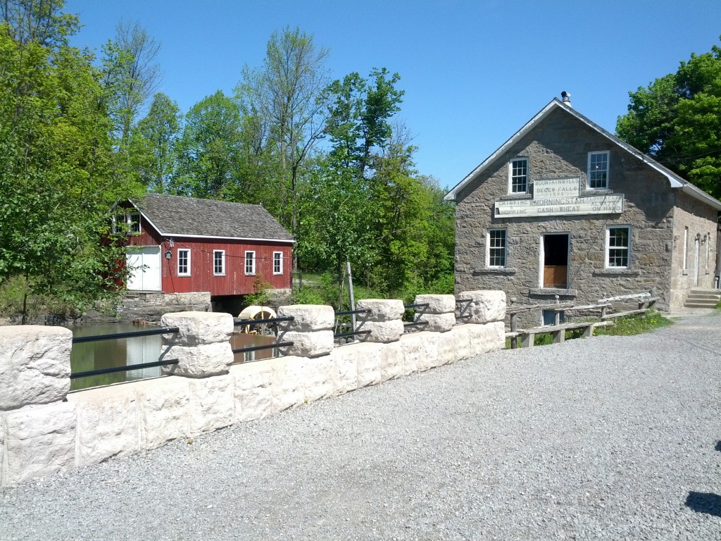
We tarried a full 40 minutes on that bench with our shoes off, feet tingling in the breeze before we decided it was time to take up the trail again. Not 10 minutes in, we stumbled onto yet another manicured lawn, this time spanning acres, and spotted with little quardened-off buildings. It turns out this was the Ball’s Falls rest point we had planned to stop at, but undershot by a good half-kilometer. The area is actually a museum of sorts – called the Ball’s Falls Grist Mill, but with no running water or cantina (read: ice cream), we walked past without giving it much notice.
After regaining the main trail at Ball’s Falls, we were in good spirits. The rest break had rejuvenated us, and it seems we may have found the right selection of food and drink to perk us up.
The trail on some of these stretches became quite difficult – as tough as we’ve seen on any of the Bruce so far, including the sheer climbs along the face of Mount Nemo a few years earlier. The tight binding on my leg was causing cramps and stiffness, but at least the bleeding was in check, which to this point had weighed constantly on my mind.
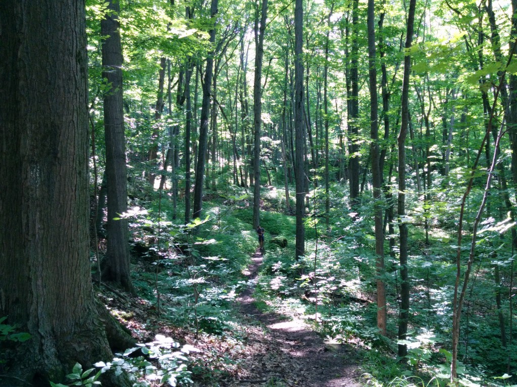
Many areas we passed through late in the day appeared untouched. We could see blazes in the distance, but no path before us. Whether due to rapid growth of ground plants, or simple disuse from the difficult conditions, the trail was at times invisible to us. The broad leaves of wild rhubarb obscured the ground below. The ramifications of a misstep still fresh in our minds, we traversed the rocky slabs and crags carefully.
A simple camera phone just can’t capture the scale of the trees and cliffs in this old Carolinian forest. That’s Will standing by a boulder along the trail in the distance.
Tracking our position by traditional methods (map, observations, chronometer) proved even more difficult for us in the last 7km stretch of our hike. A few stream-crossings made for plausible landmarks, but the in-betweens were essentially a blind forward push.
Somewhere in this stretch we stepped into a field of flat-top rock columns separated by deep divides. Will remarked that jumping from stone plateau to stone plateau felt like a video game or something you’d see in a sci-fi movie. Really, we faced no serious danger as the divides were easy to avoid, and the stone columns were flat and dry, but it was very fun.
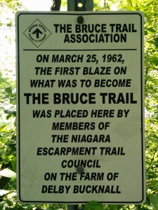
Where it all began – a monument to the first blaze on the Bruce Trail.
Cave Springs treated us to wondrous, sky-scraping trees on one side and cavernous 200-ft drops on the other. Again, our imaginations turned to the set of some sci-fi or fantasy movie. More than once we stopped to take in the sheer scale of the trees and cliffs around us.
Knowing our egress was just a few kilometres off, our pace and spirits picked up. The pressure bandaging we rigged up was causing cramping and stiffness from the knee down, and my right leg was no longer reliably holding weight. I frequently stumbled to that side, but not yet to the point of falling.
There were several points along this section of trail where the escarpment drop-off loomed only a pair of meters to our right. Variably, this sheer fall ranged from a matter of 30 feet, plunging up to 200 feet or more straight down onto the crags below. Usually there was a buffer of growth there to suppress our vertigo.
In a small clearing, we encountered another pair who were camping and had a fire going. They seemed hardly to notice us, even though we intentionally made a lot of noise on approach so as not to startle them.
With only 1km to go, we stumbled haltingly onto the ledge of a very high, sheer cliff, and thought perhaps we had lost the trail. Certainly, we were happy to turn away from that perilous fall. Doubling back and scouting, we could find no blazes or signs of passage. We reluctantly returned to the ledge. Apparently, to move forward, we would have to billy-goat our way along the edge of the rock face – maybe a foot-wide path of solid footing separating us from a certainly fatal drop into the chasm on our right. Just looking out over the drop was dizzying, and knowing we had to pass through was a real moment of truth for both of us, and our commitment to this trail.
To make matters worse, I knew that another loss of control of my leg could cause me to stumble rightwards towards the deadly drop. Will and I steeled ourselves for the short stretch of rocky path. A deep breath and a few carefully placed steps later, and we were across – dizzied but unharmed. The rest of the way would prove easy, as the adrenaline and promise of a warm meal hurried us to the end point.
We made egress at precisely 6:00PM, exactly on target. An elderly couple passing in their car pointed us around the bend to a parking lot where we knew our drive was waiting.